Residential Land For Sale
$38,550
49940 5 Mile Creek Road
Beatty, Oregon, United States
10 acres
Listed By: Landcentury
Listed On: 09/13/2023
Listing ID: GL10759099
Description
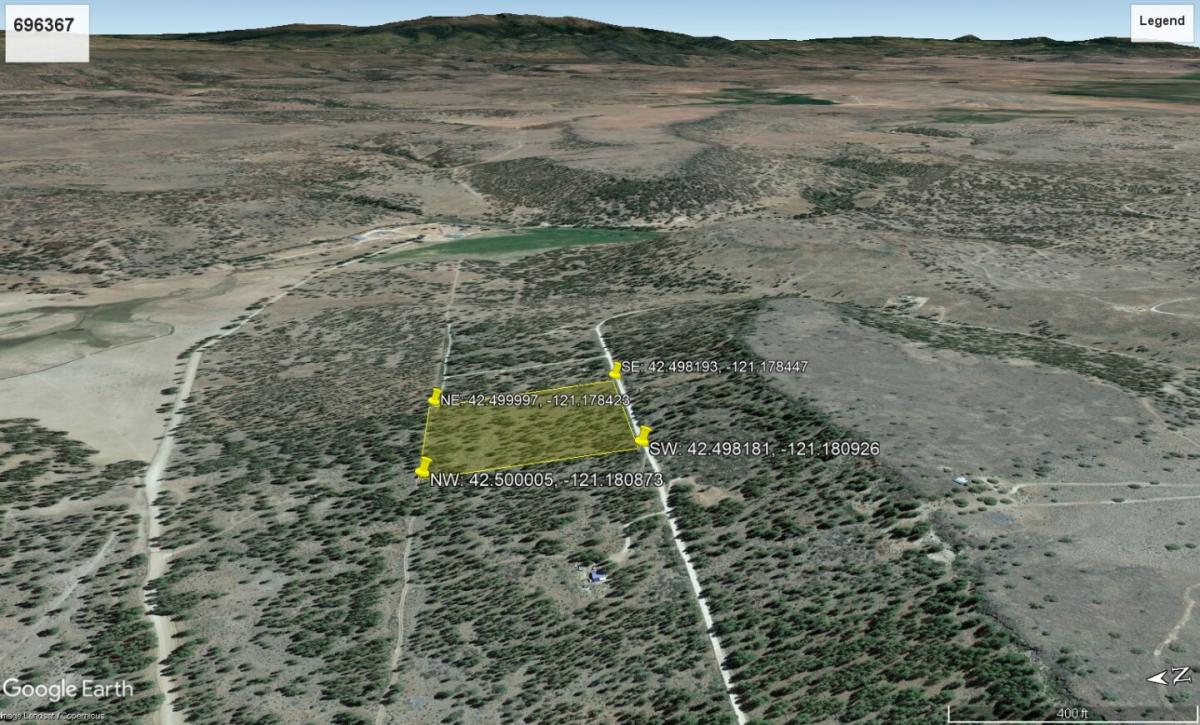
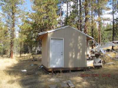
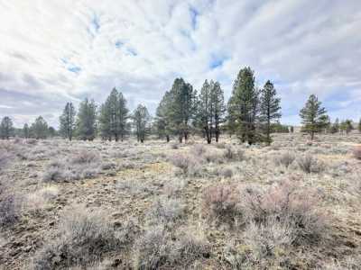
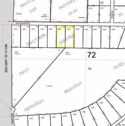
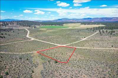
Silence is golden and you’ll have plenty of it on this 10 acre property in Klamath County near Beatty, Oregon. Head into Klamath Falls for shopping and all the modern conveniences you need. With its proximity to rivers and lakes, the fishing is top notch. Plus the area is a mecca for birdwatchers who come to see the Pacific Flyway - one of the largest migratory bird routes. While zoned for resource use, as land to grow timber, and for wildlife conservation, a dwelling can be built on the property with the right permitting and approvals. Oregon building codes should be referenced and the Klamath County planning and zoning department contacted for specifics. Min build is around 400 square feet and a temporary use permit can be secured to stay in an RV on the property while building. Get your creative juices flowing and start designing your dream property in the West. SUBDIVISION: N/A STREET ADDRESS: N/A, near N Packsaddle Cir, Beatty, OR 97621 STATE: OR COUNTY: Klamath County, OR ZIP: 97621 SIZE: 10 acres LOT DIMENSIONS: 664 feet x 668 feet APN: 696367 LEGAL DESCRIPTION: THE NEl/4 OF THE NWl/4 OF THE NEl/4 OF SECTION 33, TOWNSHIP 35 SOUTH, RANGE 13 EAST OF THE WILLAMETTE MERIDIAN, KLAMATH COUNTY, OREGON: MORE PARTICULARLY DEFINED AS FOLLOWS: BEGINNING AT AN IRON PIN LOCATED ON THE SOUTHWEST CORNER OF LOT 4, BLOCK 13, TRACT NO. 1010, FIRST ADDITION TO FERGUSON MOUNTAIN PINES, A RECORDED PLAT IN KLAMATH COUNTY, OREGON, THENCE NORTH 89°44'23" WEST ALONG THE NORTH LINE OF PACKSADDLE CIRCLE AS DEDICATED IN SAID SUBDIVISION 660.0 FEET, MORE OR LESS, TO ITS INTERSECTION WITH THE WEST LINE OF THE NEl/4 OF NWl/4 OF NEl/4, THENCE NORTH ALONG THE SAID WEST LINE 660.0 FEET, MORE OR LESS, TO THE NORTH LINE OF SECTION 33, SAID TOWNSHIP AND RANGE, THENCE SOUTH 89°42'08" EAST, ALONG THE SAID NORTH LINE 660.0 FEET, MORE OR LESS, TO AN IRON PIN LOCATED ON THE CORNER OF SAID SUBDIVISION, THENCE SOUTH 01 °19'29" WEST, ALONG SAID SUBDIVISION LINE 664.88 FEET TO THE POINT OF BEGINNING. NOTE: THIS LEGAL DESCRIPTION WAS CREATED PRIOR TO JANUARY 01, 2008. GOOGLE MAPS LINK: https://goo.gl/maps/5DAFDzTdtngnk41K6 LAT/LONG COORDINATES: NW: 42.500005, -121.180873 NE: 42.499997, -121.178423 SW: 42.498181, -121.180926 SE: 42.498193, -121.178447 ELEVATION: 4,581 feet ANNUAL TAXES: Approx. $98 per year ZONING: (FR) Forestry/Range - This property is zoned for resource use, growing trees for lumber, and wildlife conservation. Dwelling is not a primary use of the property. In order to be approved for a dwelling you will have to prove the property meets the criteria for a dwelling and the siting standards for a dwelling. You can camp on the property for 21 days in a 6 months period.You can have an RV on the property for 7 days, after 7 days a camping permit is required.You can stay in an RV while building a home via approval of a Temporary Use Permit (TUP) A TUP can only be applied for after a building permit has been issued. A TUP is reviewed on an annual basis.Mobile homes are not allowed on the property. Dwellings need to meet the Oregon Building Codes – Around 400 square feet.No time limit to build.Contact Klamath County, OR Planning and Zoning Department at Phone: 541-883-5121 Option 4, for more info. FLOOD ZONE: Unsure HOA/POA: N/A IMPROVEMENTS: None ACCESS: The property can be accessed via N Packsaddle Cir. WATER: Would be a well, water haul and holding tank or other similar option SEWER: Would be by Septic UTILITIES: Power by solar, wind or generator, Phone by cellular, satellite TV/Internet/Phone


